blah blah blah
Stairs Mountain and Mts. Resolution and Crawford
Length: 10.8 miles out-and-backDifficulty (click for info): Very Hard
Elevation Gain: 3250 feet
Rating (click for info): 9/10
Elevation: 3468' (Stairs), 3415' (Resolution), and 3119' (Crawford)
Prominence: 528' (Stairs), 355' (Resolution), and 259' (Crawford)
Driving Directions:
See the page for Mt. Craford for driving directions.
About the Hike:
This trio of peaks is located around the intersection of the Bemis and Montalban Ridges - Crawford on the Bemis Ridge, and Resolution and Stairs on the Montalban. The peaks are a prominent landmark in the southern Presidential Range-Dry River Wilderness, identifiable from many far away places, usually due to the Giant Stairs, the abrupt step-like ridge on the south side of Stairs's summit. The peaks are often hiked together, as they make for an exciting day-long adventure into the wilderness. Each provides a different perspective of the same terrain: Crawford has the best look down into the valleys below, Resolution has the widest and most open view, and Stairs is the deepest in the wilderness and feels the most secluded. Along the trail, you will experience the wild character of the Presidential Range-Dry River Wilderness.
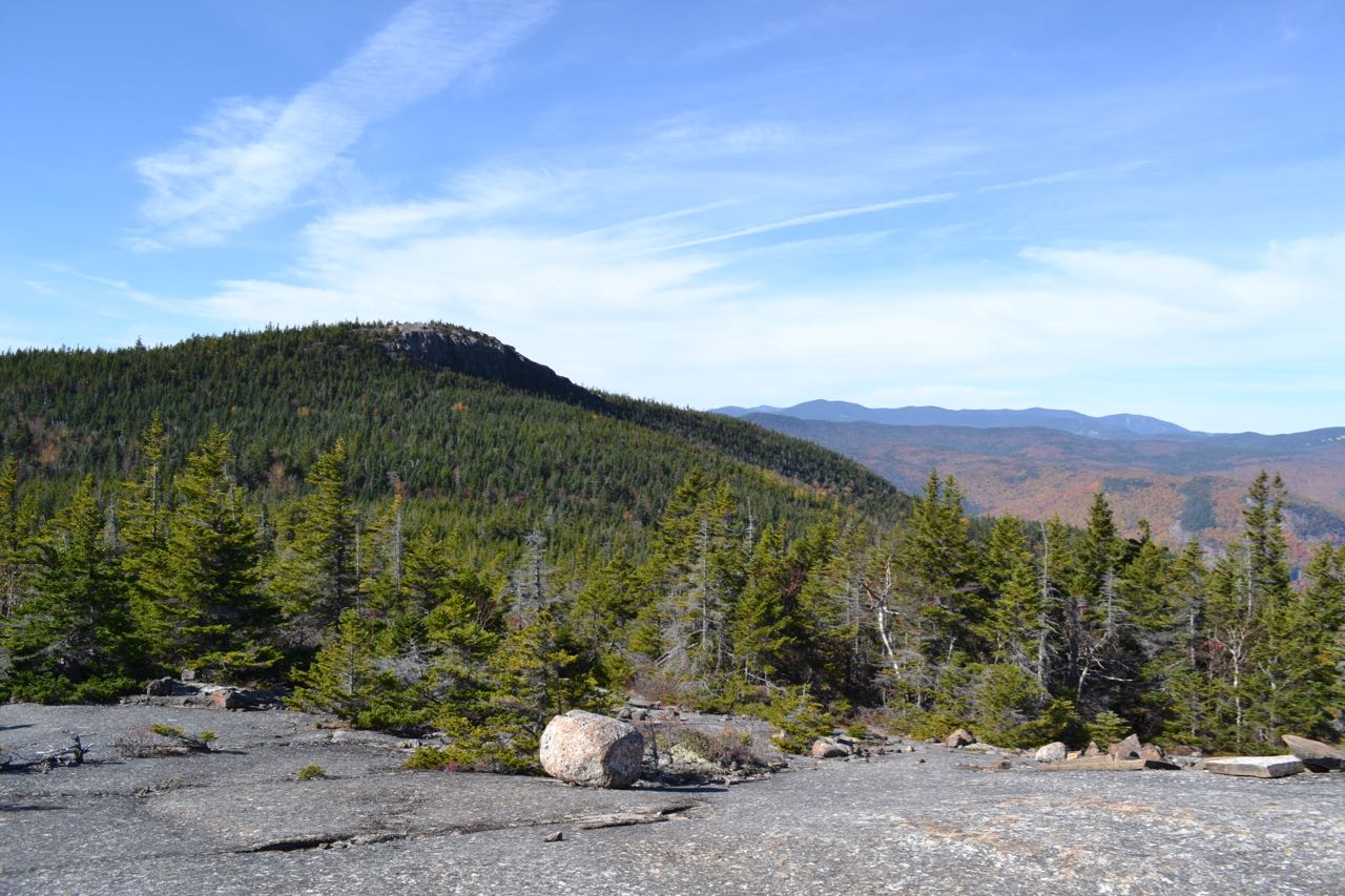
The first peak visited on this trek is Mt. Crawford. The hike to Mt. Crawford alone is described in detail on a separate page, so for the description of the hike up to that point, see that page. When you have finished enjoying the view from Mt. Crawford, return down the summit spur path and continue on the Davis Path. The trail dips slightly into the woods, leading down to the col between Crawford and Resolution in 0.2 miles, then gently rises in another 0.1 miles to open ledges on a flat section of the ridge. After a few seconds, you can look back at the cliffy summit of Mt. Crawford. After rising to some smaller ledges, the path makes a minor descent, still with the gradual nature of the ridge-top so far, to a col between Mt. Resolution and a minor peak on the ridge known as Crawford Dome. In the middle of this small descent, the trail skirts the southeast slope of Crawford Dome, passing a large sloping ledge on the left side of the trail which you can climb up a short distance for a view ahead to the slope of Mt. Resolution, spotted with huge gravelly patches. Beyond the col, the trail can no longer follow the Bemis Ridge, since it blends into the steep side of Mt. Resolution to merge with the Montalban Ridge. Instead, the trail contours along the west side of Mt. Resolution for the next 0.7 miles, passing below one of the large gravel patches and crossing two drainages. It changes little in elevation in this section. After this, reach a junction with Mt. Parker Trail. Turn right onto this trail, which quickly becomes steep and ledgy, and in just 0.1 miles, emerges on a fantastic open ledge with views to the north and west. More of this awaits beyond. The Mt. Parker Trail continues to ascend steeply, then becomes much more gradual, and re-emerges on open ledges after 0.4 miles.
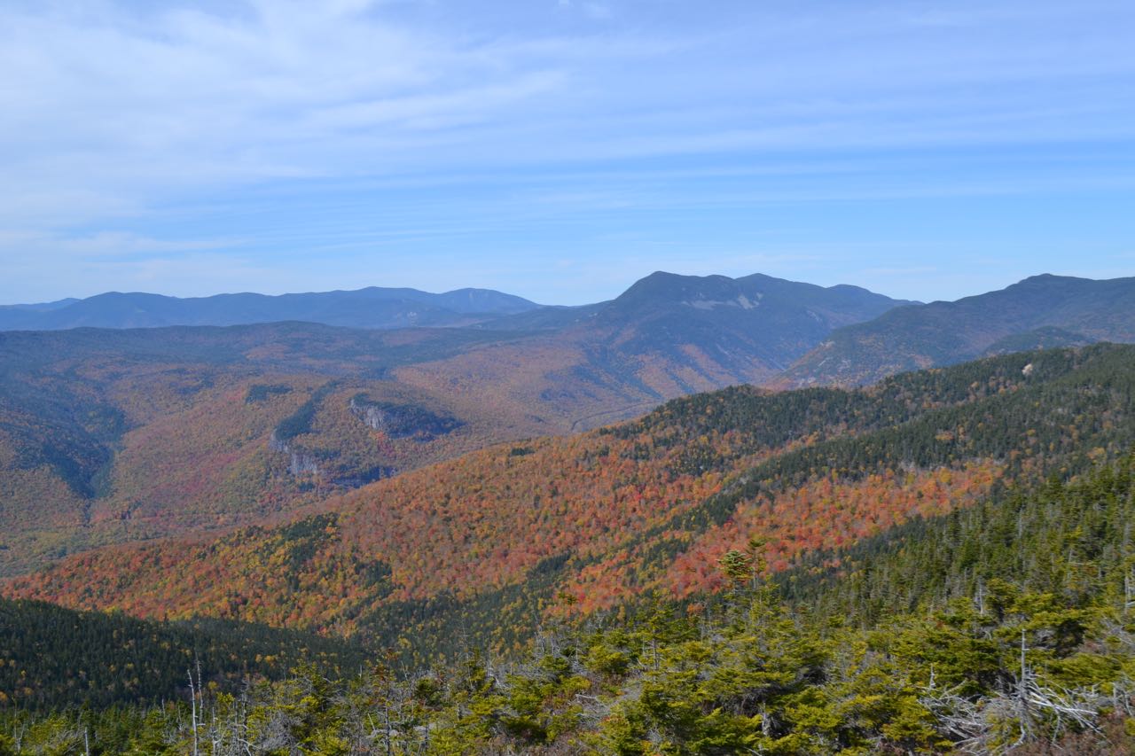
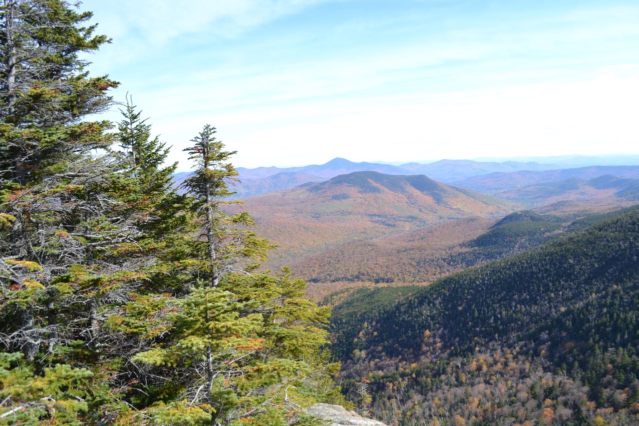
This area is at the south end of the long summit plateau of Mt. Resolution. The highest point is on the other end, but is not accessible by trail. From this wide open area, there are breathtaking views in three directions. To the southwest, you look out to the Sandwich Range over Mt. Tremont. To the west, you observe beautiful layers of mountains. Mt. Carrigain rises mightily in the distance behind the high plateau and round peaks of the Nancy Range. Nearby Mt. Crawford pokes up from the ridge in front. To the northwest, Frankenstein Cliff is carved out of the side of the massively broad ridge connecting the Nancy Range to the Willey Range. Beyond the ridge is the Twin Range. Further to the north, you look into Crawford Notch, although the distance into the notch you can see is diminished as you have moved further to the east. You do have a better view of the Southern Presidentials from here, however. They lift the low Mt. Webster over the many 4000-footers all the way to Mt. Washington. Below the ridge, in the middle, you look ahead to Stairs Mountain; its large stair-step is not visible since you are observing it straight on.
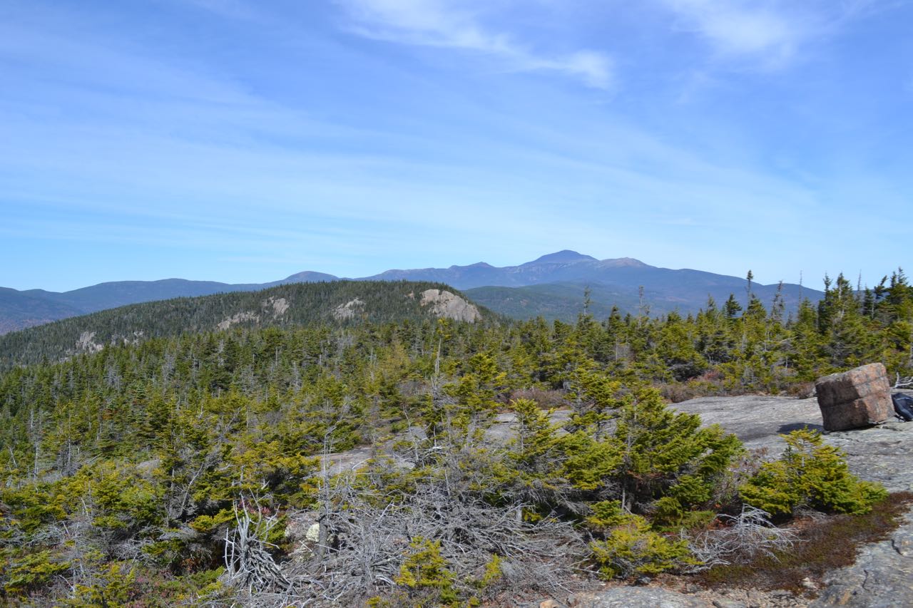
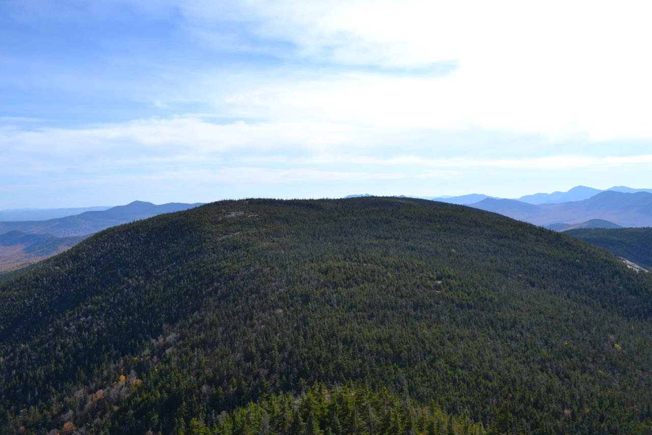
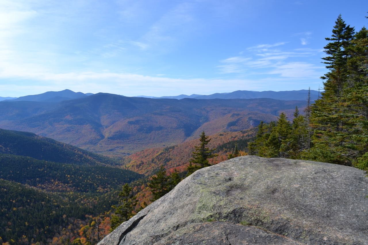
To continue to Stairs Mountain, return along the Mt. Parker Trail to the Davis Path. The Davis Path continues its course around the west slopes of Resolution, reaching its lowest point just below Stairs Col in 0.3 miles, where there is a junction with Stairs Col Trail. The trail must now take a roundabout route to avoid the cliffs of the two steps of Stairs Mountain. Bear left to stay on Davis Path as it ascends moderately to the west of the steps, then flattens out and contours around 3200 feet in elevation for a while. Eventually, it turns to the right and climbs up a steep slope beside some smaller cliffs. This is one of the steepest sections of the hike, and involves some minor rock scrambles. At a point where the trail turns left and uphill, look for an unmarked spur path continuing straight ahead to a viewpoint at the top of a precipitous face. Continuing on, the trail soon reaches the ridge top, where the Davis Path continues up the Monatalban Ridge on its 15-mile journey to Mt. Washington and a 0.2-mile spur departs on the right and runs across the flat top of Stairs Mountain through dark forest to the top of the cliff which makes up the top step. The view from here is not quite as open as Resolution's view, but as mentioned previously, feels the most isolated and secluded. The huge mass of Mt. Resolution blocks out much of the view and serves as a visual indicator of how far you have come. To the left of it, you have a different view to the east; it overlooks the valleys of Lower Stairs Brook, then Rocky Branch. Iron Mountain stands in front of Kearsarge North and its small mountain range. To the right of Resolution, you can see much of the same terrain that you could see before, but now from a further removed perspective where you look out over the valley of Sleeper Brook.
Printable directions page